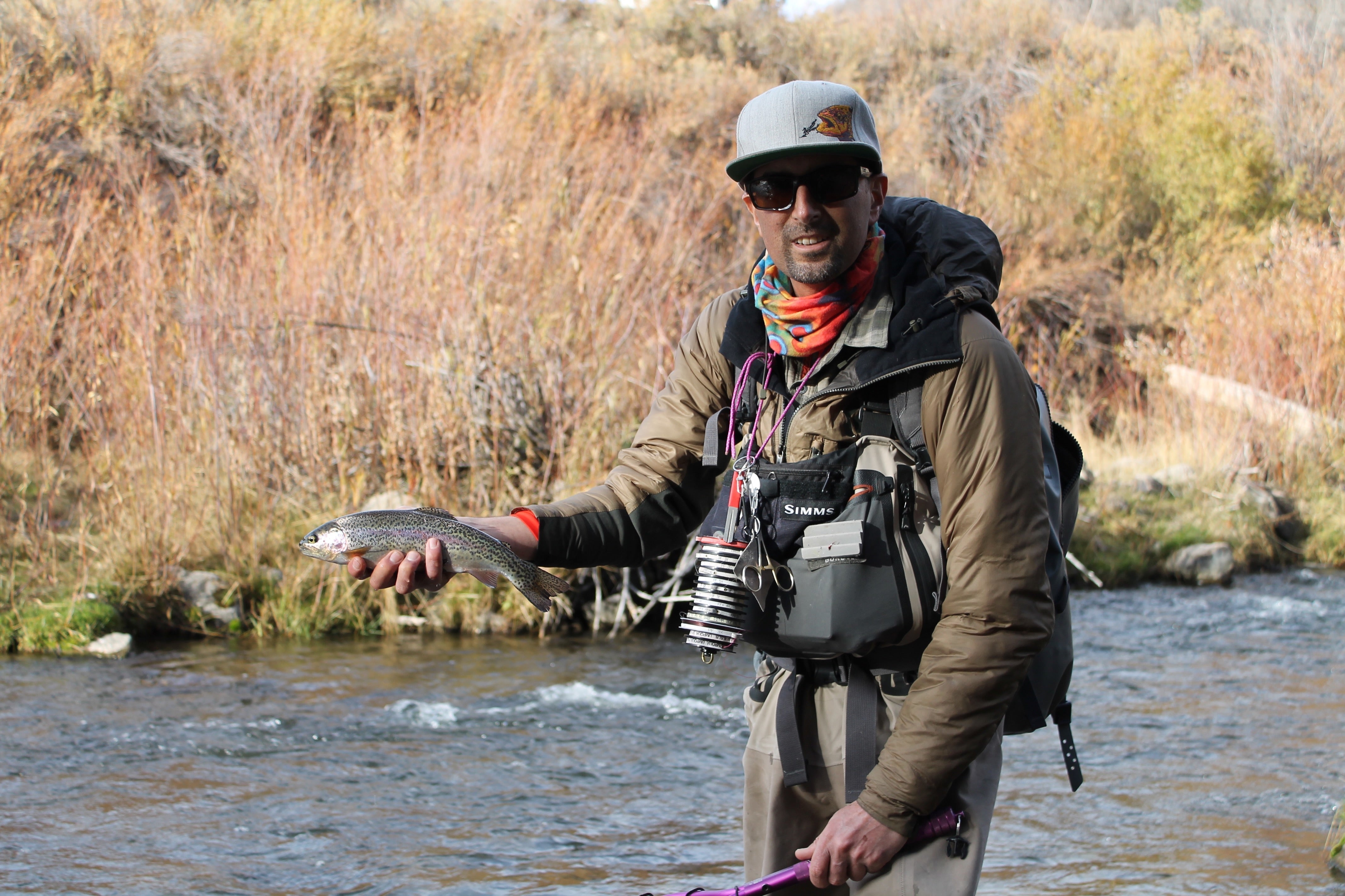
Short answer: The Provo River is three fisheries in one. The Upper Provo is a freestone flowing from the Uinta Mountains to Jordanelle Reservoir. The Middle Provo is a walk-and-wade tailwater from Jordanelle Dam to Deer Creek Reservoir near Park City and Heber. The Lower Provo is a tailwater from Deer Creek Dam through Provo Canyon to Utah Lake.
The Provo is my home river. I live in Park City, and the Middle Provo is about 20 minutes from town. Most articles about the Provo, including our own Middle Provo in depth, focus on that one famous stretch. This guide covers the whole river, top to bottom: where each section starts and ends, how you get on it legally, the rules that change from one bridge to the next, when the bugs come off, and what our podcast guests who fish it every week have shared about pressured Provo trout.
Where is the Provo River, and how is it divided?
The Provo River rises in the Uinta Mountains east of Kamas, Utah, and flows southwest through two reservoirs before ending in Utah Lake at Provo. Park City guide Zach Lassek laid out the three sections on the Fly Fishing Insider Podcast: the Upper is a freestone starting in the Uintas, the Middle is controlled by releases from Jordanelle Reservoir between Park City and Heber, and the Lower is controlled by Deer Creek Reservoir below Heber on the way down to Provo.
| Section | From / to | Water type | Main access | USGS gauge |
|---|---|---|---|---|
| Upper Provo | Uinta headwaters to Jordanelle Reservoir | Freestone; runoff-driven | Mirror Lake Scenic Byway (SR-150) east of Kamas; Rock Cliff at Jordanelle State Park | Near Woodland |
| Middle Provo | Jordanelle Dam to Deer Creek Reservoir | Tailwater; wade only | Seven Provo River Restoration Project parking areas, Heber Valley | Near Hailstone, River Road Bridge, Near Charleston |
| Lower Provo | Deer Creek Dam through Provo Canyon to Utah Lake | Tailwater; canyon river | US-189 through Provo Canyon: below Deer Creek Dam, Vivian Park, the Tunnels | At Provo (in town, below the canyon) |
Upper Provo: Uinta headwaters to Jordanelle
The Upper Provo is the freestone part of the river, and it behaves like one. It rises and colours with snowmelt in late spring, then drops and clears into summer. The easiest access is the Mirror Lake Scenic Byway (SR-150), which the Utah Office of Tourism describes as a 42-mile road from Kamas to the Wyoming line that tops out at 10,715 feet at Bald Mountain Pass and is typically open to cars from mid-May to mid-fall. Provo River Falls is the best-known stop along it.
Along the byway the river runs through the Uinta-Wasatch-Cache National Forest. The Forest Service lists river fishing at Soapstone Campground, about 16 miles east of Kamas on SR-150, where the Provo flows right alongside the sites. The Mirror Lake Scenic Corridor is a fee area: a standard amenity pass starts from $10 for 3 days, and America the Beautiful passes are honoured.
Below the national forest, the Upper Provo runs through the Woodland and Kamas valley, where much of the bank is private. Under Utah law you may not walk on a privately owned streambed without permission, so stick to public land and lawful access points. At the bottom of this section, Jordanelle State Park's Rock Cliff area on SR-32 lists river access among its amenities.
The 2026 Utah Fishing Guidebook sets special rules on the Upper Provo from Jordanelle Reservoir upstream to the confluence of the North and South forks: artificial flies and lures only, a limit of 2 brown trout under 15 inches, and all cutthroat trout, rainbow trout and their hybrids must be released immediately. Above the forks, statewide rules apply.
Middle Provo: Jordanelle Dam to Deer Creek
The Middle Provo is the stretch most people mean when they say "the Provo." It is a tailwater, so cold, steady water from the bottom of Jordanelle Reservoir keeps it fishing all year. Zach Lassek puts it about 20 minutes from Park City and less than an hour from Salt Lake City, and he describes it as more of a stream than a big river.
Most public access comes from the Provo River Restoration Project, run by the Utah Reclamation Mitigation and Conservation Commission between Jordanelle Dam and Deer Creek Reservoir. River reconstruction was completed in 2008, and the Commission's angler access page describes a 12-mile public corridor served by seven designated parking areas, two of them built for anglers with physical disabilities. Enter and leave only at those access points, because private property borders the corridor. Boating, camping, hunting and bicycles are all prohibited in the corridor, which is why Zach calls the Middle Provo all wade fishing with no drift boats.
Two sets of rules apply on the Middle Provo under the 2026 guidebook. From Jordanelle Dam down to Legacy Bridge on Midway Lane (SR-113): artificial flies and lures only, limit 2 trout under 15 inches. From Legacy Bridge down to Deer Creek: statewide regulations. The Utah Division of Wildlife Resources calls brown trout and whitefish the best targets on the upper Middle Provo and points to June and sometimes July for the green drake hatch.
For access points, run by run notes and how this tailwater fishes month to month, read our Middle Provo in depth guide.
Lower Provo: Deer Creek Dam to Utah Lake
The Lower Provo leaves Deer Creek Dam and runs down Provo Canyon beside US-189 before it passes through the city of Provo and into Utah Lake. It is the other tailwater on the river, and it is heavily used. A Utah Watershed Restoration Initiative project report on Lower Provo angler access cites a 2004 creel survey that found about 28,000 angler hours per mile, says summer weekend use runs into the thousands, and lists brown trout, rainbow trout, mountain whitefish and Bonneville cutthroat trout as the fish anglers target.
The same report describes the main access improvements: a paved parking area, boat ramp, stairs and handrails directly below Deer Creek Dam just south of US-189, next to the river bridge and a permanent restroom, plus improved takeouts near the Vivian Park Bridge and the Tunnels area. The report also warns that recent private land purchases have cost anglers some historic access, so read the signs before you step in.
From Deer Creek Dam down to the Olmstead Diversion Dam, the 2026 guidebook sets artificial flies and lures only and a limit of 2 trout under 15 inches. Below Olmstead the river leaves the canyon and runs through Orem and Provo. In the last stretch, from I-15 down to the Center Street Bridge at Utah Lake State Park, all suckers must be released immediately; the guidebook notes that the threatened June sucker lives in Utah Lake and the Provo River.
What are the Provo River fishing regulations?
The Provo River changes rules several times between the Uintas and Utah Lake. This summary comes from the 2026 Utah Fishing Guidebook; read the current edition before every trip, because the Utah Division of Wildlife Resources revises it regularly.
| Stretch | Rules (2026) |
|---|---|
| Above the North and South Fork confluence | Statewide rules: 4 trout combined daily limit |
| Forks confluence down to Jordanelle Reservoir | Artificial flies and lures only; 2 brown trout under 15 inches; release all cutthroat, rainbows and hybrids |
| Jordanelle Dam to Legacy Bridge (Midway Lane, SR-113) | Artificial flies and lures only; 2 trout under 15 inches |
| Legacy Bridge to Deer Creek | Statewide rules |
| Deer Creek Dam to Olmstead Diversion Dam | Artificial flies and lures only; 2 trout under 15 inches |
| Olmstead Diversion Dam to I-15 | Statewide rules |
| I-15 to Center Street Bridge (Utah Lake State Park) | Release all suckers; walleye and northern pike rules apply |
You need a Utah fishing licence if you are 12 or older. On the DWR fee schedule, a 3-day licence starts from $19 for residents and $44 for nonresidents.
When is the best time to fly fish the Provo River?
The best time depends on the section. The Middle and Lower Provo are tailwaters and fish all year, with June and July standing out on the Middle Provo for green drakes, according to the Utah DWR. The Upper Provo is best after runoff, once the Mirror Lake Highway is open and the water drops and clears, usually through summer into early fall.
Bert Ley of the Utah Stream Access Coalition told the Fly Fishing Insider Podcast that the Middle and Lower Provo both have phenomenal caddis, with the evening fishing running into September. The DWR does not publish a Provo hatch chart, so treat everything in the table below except the green drake and caddis rows as general guidance for Utah tailwaters, not a promise.
| Bug | Jan | Feb | Mar | Apr | May | Jun | Jul | Aug | Sep | Oct | Nov | Dec |
|---|---|---|---|---|---|---|---|---|---|---|---|---|
| Midges | Peak | Peak | Peak | Fair | Fair | Fair | Fair | Fair | Fair | Fair | Peak | Peak |
| Blue-winged olives | Fair | Peak | Fair | Fair | Peak | Fair | ||||||
| Pale morning duns | Fair | Peak | Peak | Fair | ||||||||
| Green drakes (DWR) | Peak | Fair | ||||||||||
| Caddis (Bert Ley) | Fair | Fair | Peak | Peak | Peak | |||||||
| Hoppers, ants, beetles | Fair | Peak | Peak | |||||||||
| Streamers for browns | Fair | Fair | Peak | Peak | Fair |
Peak: the bug is the main event most days. Fair: worth carrying. Blank: rarely matters. Flows, weather and snowpack shift these windows every year.
New to the small mayflies? Our guide to identifying a blue-winged olive hatch covers the bug that drives spring and fall on both tailwaters.
What flies work on the Provo River?
Provo trout see a lot of flies, so think small and natural. Carry midges and small mayfly patterns for the tailwaters, a green drake for early summer on the Middle Provo, caddis for summer evenings, and a few nymphs heavy enough to reach the bottom. Every fly below is in stock in the Fly Fishing Insider Podcast shop.
 Black Zebra Midge, Size 18Starting from $24.95
 Sparkle Dun Baetis, Size 18Starting from $15.95
 CDC PMD Emerger, Size 16Starting from $15.95
 Green Drake Dry FlyStarting from $0.99
 Elk Hair Caddis AssortmentStarting from $21.95
 Parachute Adams Dry FlyStarting from $0.99
 Tungsten Copper John Euro NymphsStarting from $23.95
 Trout Skin Nipper w/ Eye CleanerStarting from $4.29
How do you catch pressured trout on the Provo River?
Zach Lassek guides the Middle Provo and called it the most pressured river he has ever encountered. On How it Feels to Be a New Guide on High Pressured Water (Season 5, Episode 201, July 4, 2023), he walked through how he adjusts for Provo trout. Here is the substance, paraphrased:
- Presentation beats pattern. As long as the fly is in the range of what is hatching, Zach puts more weight on how the fly drifts past the fish than on the exact pattern. For dries he wants a clean, long leader and fine tippet, and he named 6.5X as a game changer on the Provo, with floatant to keep the fly riding high.
- Learn the bounce rig. Zach called the bounce rig the standard Provo nymphing setup: a main line (5X for most of the season), flies on tags spaced roughly 14 to 20 inches apart depending on flow, and the weight at the very end instead of on the line between the flies.
- Move when it is not working. Have a plan A, B, C and D. Sometimes the tail of a run fishes when the head does not, and sometimes the answer is a different spot entirely.
- Carry a sewing needle and two markers. A fine sewing needle clears head cement out of a tiny hook eye faster than the pick on most nippers, and a black and a brown permanent marker let you darken a fly on the water when the naturals are darker than your pattern.
My own early Provo lesson is from that same episode. A friend watched me miss my drift, and instead of re-teaching my cast he moved me two steps; the same cast suddenly landed where it needed to. When the fish started hitting at the end of my drift, as the flies lifted, he switched me to emergers and it was lights out. Small changes in position and fly stage matter on this river.
For the caddis evenings, Bert Ley's advice on Stream Access: What Happens Behind Closed Doors (Season 3, Episode 127, July 20, 2021) is simple: rig your rod before the sun goes down, find a pool below a riffle, wait for the fish, and bring a headlamp with a red light so you keep your night vision. His full tip is in our Tips Library: rig before dark and fish a riffle-fed pool for the dusk caddis push.
How do flows and dam releases affect the Provo River?
Provo River flows are set by snowmelt on the Upper Provo and by dam releases on the Middle and Lower. Check the live USGS gauge for the section you plan to fish: near Woodland for the Upper, near Hailstone just below Jordanelle, River Road Bridge and near Charleston for the Middle. The only active USGS gauge on the Lower is at Provo, in town below the canyon, so it does not show what is coming out of Deer Creek.
Zach made the point that a big snow year changes everything on a tailwater. Water managers push more water out ahead of runoff, he expected fish to shift toward the banks and softer water, and crossings you make every summer can become unsafe. He told the story of turning back halfway across one of his favourite crossings because the flow was too strong. If a crossing feels wrong, fish from the bank side and save that run for another day.
Is the Provo River good for beginners?
The Provo River is a hard first river but a good place to learn, especially with a guide. Zach said many of his clients have never fished before, and that relaxed first-timers often do better than they expect. The tailwater trout are pressured and selective, so a beginner fishing alone should expect a slow day on the Middle Provo. The Upper Provo's broken pocket water is more forgiving because the riffled surface hides leaders and small mistakes.
How crowded is the Provo River?
Very, especially the Middle and Lower in summer. Zach described the Middle Provo as busy on almost any day, with parking lots full and 8 a.m. on a summer weekend already too late. On the Lower Provo, the Watershed Restoration Initiative report puts summer weekend use in the thousands. For room to yourself, fish early on weekdays, go in the cold months on the tailwaters, or head up the Mirror Lake Highway once it opens.
How much does it cost to fish the Provo River?
Fishing the Provo River on your own costs a Utah fishing licence plus any site fee where you park. A 3-day licence starts from $19 for residents and $44 for nonresidents on the DWR fee schedule, and anglers under 12 do not need one. The Mirror Lake Scenic Corridor on the Upper Provo starts from $10 for a 3-day pass, and Rock Cliff sits inside Jordanelle State Park, so check the park's current entry fees before you go.
Can you wade anywhere on the Provo River?
No. Utah's water is public, but the bed under it often is not. The Utah DWR stream access page says the 2010 law (H.B. 141) does not let anglers walk on the private bed of a public waterbody without permission. You may float over private land and fish from the boat if you launch at a lawful access point and keep moving, but the Middle Provo restoration corridor bans boating. Bert Ley walks through how this law came to be in his episode. On the Provo, start at a marked public access point and stay inside the signed corridor.
Where else can you fish near the Provo River?
Want more advice from our guests? Browse every tip in the Fly Fishing Tips Library, sorted by region, water type, species and skill.
Plan your trip: See our Utah Location Details page for every FFIP Utah guide, the stream access rules and the best months across the state.
Book the season you actually want
The best weeks go first, and the difference between a good trip and a great one is usually timing. Tell us the season you want and we'll find the water that fishes then.
Book a TripFly Fishing Insider Podcast has a referral partnership with Frontiers International Travel. If you book after being introduced through us, we may receive compensation at no additional cost to you.
Tight lines, everyone!
By Christian Bacasa, host of the Fly Fishing Insider Podcast. Last reviewed October 2026.
Prices, availability, flight routing and entry requirements change. Every figure on this page is the starting rate published by the lodge or by Frontiers International Travel at the time of writing, per angler, and is a starting point for a quote, not a quote. Seasons, lodge capacity, charter schedules, visa and passport rules and licence requirements can all change without notice. Confirm current pricing, availability and entry requirements with your Frontiers specialist before you book anything.
Sources: Regulations, licence age and June sucker: 2026 Utah Fishing Guidebook. Licence fees: Utah DWR fee schedule. Stream access: Utah DWR. Middle Provo species and green drake timing: Utah DWR, May 2026. Middle Provo corridor and access: Utah Reclamation Mitigation and Conservation Commission. Lower Provo access, use and species: Utah Watershed Restoration Initiative. Upper Provo byway, campground and fees: USDA Forest Service and Utah Office of Tourism. Rock Cliff access: Utah State Parks. Flows: USGS gauges linked above. Podcast insight: Zach Lassek and Bert Ley on the Fly Fishing Insider Podcast.